
Busia County, Kenya Agricultural Fields 2019
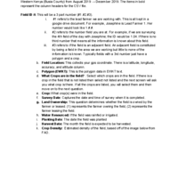
This is a dataset formatted as a CSV file that includes data collection using OpenDataKit (ODK) from field surveys in Busia County Kenya from August 2019 through December 2019 for the short rains season. The field sampling was random, based on a pre-existing community network structure. The data collected includes field boundaries (EWKT format), GPS Coordinate point, altitude, accuracy (generic settings of ODK), Crop Type, Variety (if known), Surveyor name (represented as a number), Survey Date, field ownership status, irrigation type, planting date, harvest date, the density of green leaf area index, disease prevalence for cassava and maize, any other diseases noted.
Citation
Files
-
View: ODK Collect Surveys Attribute Information Definitions.pdf
Download: ODK Collect Surveys Attribute Information Definitions.pdf
View: ODK Collect Surveys - Dream Team - Scholarsphere_Aug122019_Dec212019.csv
Download: ODK Collect Surveys - Dream Team - Scholarsphere_Aug122019_Dec212019.csv
Metadata
Work Title Busia County, Kenya Agricultural Fields 2019 Subtitle From Village to Globe: A dynamic real-time map of African fields through PlantVillage Access Creators - Annalyse Kehs
- Peter C Mccloskey
- David Hughes
- Derek Morr
Keyword - mapping
- Kenya
- agriculture
- ground truthed
- Earth Observations
- Sentinel
- crowd-sourcing
License Public Domain Mark 1.0 Work Type Dataset Acknowledgments - John Chelal
- Stellah Amakove
- Bismark Plimo
- John Mayieka
- Gladys Ntango
- Kelvin Nyongesa
- Lawrence Pamba
- Melodine Jeptoo
- James Mugo
- Mercyline Tsuma
- Winnie Onyango
Publisher - biorxiv.org
Publication Date 2021 Subject - Agriculture
Language - English
DOI doi:10.26207/k40m-1393 Publisher Identifier (DOI) - 10.1101/2019.12.19.882936
Geographic Area - Busia County
- Kenya
Related URLs - biorxiv.org/content/10.1101/2019.12.19.882936v1
Deposited February 19, 2021 Versions
Analytics
Collections
Work History
Version 1
published-
Created
-
Updated Keyword, Subject, Language, and 3 more Show ChangesKeywordSubject
- mapping agriculture, Kenya
Language- Agriculture
Geographic Area- English
Description- Busia County, Kenya
Publication Date- This is a dataset formatted as a CSV file that includes data collection using OpenDataKit (ODK) from field surveys in Busia County Kenya from August 2019 through December 2019 for the short rains season. The field sampling was random, based on a pre-existing community network structure. The data collected includes field boundaries (WKT format), GPS Coordinate point, altitude, accuracy (generic settings of ODK), Crop Type, Variety (if known), Surveyor name, Survey Date, Lead Farmer Name, field ownership status, irrigation type, planting date, harvest date, density of green leaf area index, disease prevalence for cassava and maize, any other diseases noted.
- 2021
-
Updated Acknowledgments Show ChangesAcknowledgments
- John Chelal, Stellah Amakove, Bismark Plimo, John Mayieka, Gladys Ntango, Kelvin Nyongesa, Lawrence Pamba, Melodine Jeptoo, James Mugo, Mercyline Tsuma, Winnie Onyango
-
Added Creator Annalyse Kehs
-
Added Creator Peter C Mccloskey
-
Added Creator David Hughes
-
Added Creator Derek Morr
-
Updated Keyword Show ChangesKeyword
mapping agriculture, Kenya- mapping, Kenya, agriculture, ground truthed, Earth Observations, Sentinel, crowd-sourcing
-
Added
ODK Collect Surveys - Dream Team - Scholarsphere_Aug122019_Dec212019.csv -
Added
ODK Collect Surveys Attribute Information Definitions.pdf -
Updated Subtitle, Publisher, Publisher Identifier (DOI), and 3 more Show ChangesSubtitlePublisher
- From Village to Globe: A dynamic real-time map of African fields through PlantVillage
Publisher Identifier (DOI)- biorxiv.org
Description- 10.1101/2019.12.19.882936
Related URLsThis is a dataset formatted as a CSV file that includes data collection using OpenDataKit (ODK) from field surveys in Busia County Kenya from August 2019 through December 2019 for the short rains season. The field sampling was random, based on a pre-existing community network structure. The data collected includes field boundaries (WKT format), GPS Coordinate point, altitude, accuracy (generic settings of ODK), Crop Type, Variety (if known), Surveyor name, Survey Date, Lead Farmer Name, field ownership status, irrigation type, planting date, harvest date, density of green leaf area index, disease prevalence for cassava and maize, any other diseases noted.- This is a dataset formatted as a CSV file that includes data collection using OpenDataKit (ODK) from field surveys in Busia County Kenya from August 2019 through December 2019 for the short rains season. The field sampling was random, based on a pre-existing community network structure. The data collected includes field boundaries (EWKT format), GPS Coordinate point, altitude, accuracy (generic settings of ODK), Crop Type, Variety (if known), Surveyor name (represented as a number), Survey Date, field ownership status, irrigation type, planting date, harvest date, the density of green leaf area index, disease prevalence for cassava and maize, any other diseases noted.
License- biorxiv.org/content/10.1101/2019.12.19.882936v1
- http://creativecommons.org/publicdomain/mark/1.0/
-
Published
-
Updated
-
Updated
-
Updated
Version 2
published-
Created
-
Deleted
ODK Collect Surveys Attribute Information Definitions.pdf -
Added
ACCESSIBLE_VERSION_ODK Collect Surveys Attribute Information Definitions.pdf -
Published
-
Updated
-
Updated Work Title Show ChangesWork Title
Busia County, Kenya Agricultural Fields 2019- Data for "From Village to Globe: A dynamic real-time map of African fields through PlantVillage" August 2019-December 2019
-
Updated Subtitle, Publisher, Related URLs Show ChangesSubtitlePublisher
From Village to Globe: A dynamic real-time map of African fields through PlantVillage
Related URLsbiorxiv.org
biorxiv.org/content/10.1101/2019.12.19.882936v1- http://dx.doi.org/10.3389/fsufs.2021.514785, https://doi.org/10.1101/2019.12.19.882936
-
Updated
-
Updated Publisher Identifier (DOI) Show ChangesPublisher Identifier (DOI)
10.1101/2019.12.19.882936
-
Renamed Creator Peter Mccloskey Show Changes
Peter C Mccloskey- Peter Mccloskey