
Urban Tree Patterns Impacts on Urban Microclimate
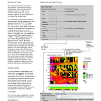
This poster presents a novel spatial data pipeline supporting an ongoing collaborative urban heat island (UHI) research study. This study aims to evaluate the existing tree canopy patterns’ impacts, as landscape metrics, on potential air temperature.
Files
-
Metadata
Work Title Urban Tree Patterns Impacts on Urban Microclimate Subtitle A geospatial simulation data pipeline for multi-neighborhood scale landscape metric analyses Access Creators - Travis Flohr
- Mehdi Heris
- Elizabeth Derycke
Keyword - Urban heat island
- Urban tree canopy
- Landscape metrics
- Urban microclimate simulation
- Computer simulation
- Data pipeline
License CC BY-NC 4.0 (Attribution-NonCommercial) Work Type Poster Publication Date September 23, 2021 Source - Fall 2021 Stuckeman Research Open House
Deposited February 23, 2022 Versions
Analytics
Collections
Work History
Version 1
published-
Created
-
Added Creator Travis Flohr
-
Added Creator Mehdi Heris
-
Added Creator Elizabeth Derycke
-
Added
Urban Flohr.pdf -
Updated License Show ChangesLicense
- https://creativecommons.org/licenses/by-nc/4.0/
-
Updated Subtitle Show ChangesSubtitle
A geospatial simulation data pipeline for multi-neighborhood scale landscape metric analyses met- A geospatial simulation data pipeline for multi-neighborhood scale landscape metric analyses
-
Published
-
Updated
-
Updated
-
Updated
Version 2
published-
Created
-
Deleted
Urban Flohr.pdf -
Added
ACCESSIBLE_VERSION_Urban Flohr.pdf -
Published